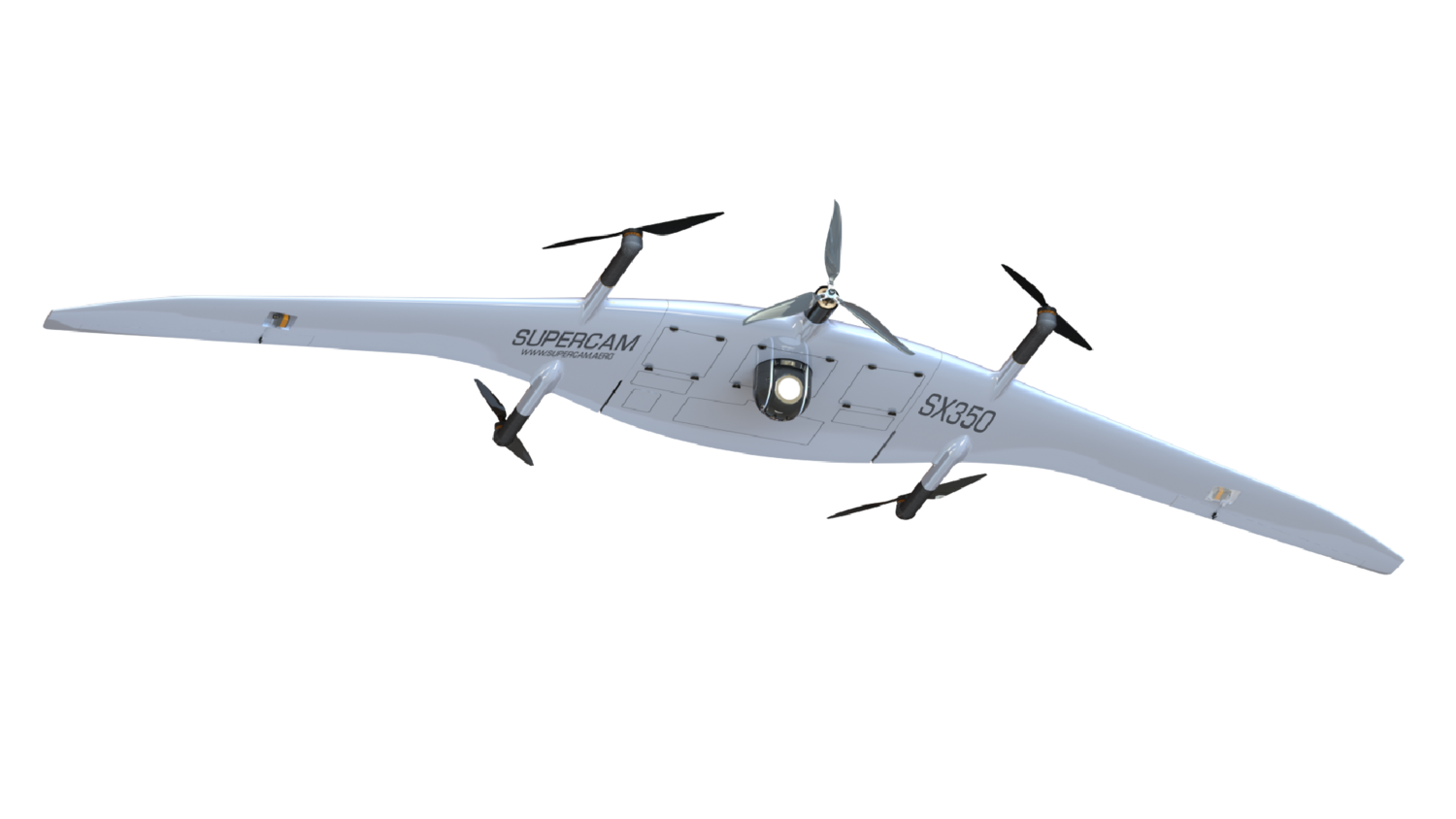
Supercam SX350 is the first mass-produced unmanned convertiplane (or tilt-rotor aircraft) that combines design features of fixed wing and rotary wing UAVs. The main advantages of this model are vertical takeoff and landing, no need to search for a big takeoff and landing area, as well as the ability of various payloads integration. The unmanned aircraft is designed to perform highly detailed aerial photography and video monitoring at any time of the day over large areas, as well as in remote areas, and under various environmental conditions. The convertiplane can fly for up to 120 minutes, while having a maximum speed of 120 km/h.
The aircraft can transmit HD video in real time within a range of up to 50 km, be equipped with an automatic target tracking module, and accurately determine the object coordinates. The aerodynamic design allows combining various types of unified payloads including photo and video cameras. In addition, the UAV can be equipped with multispectral cameras, laser gas analyzers, laser scanners, and high-precision geodetic equipment.
Specifications
Specifications
Wingspan - 3.2 m
Endurance - up to 120 min
Speed - 70 - 120 km/h
Radio link range - 50 km
Video transmission range - up to 50 km
Max flight range - 160 km
Max takeoff weight - 13.5 kg
Operational height - 150 - 3000 m
Takeoff / landing
Takeoff / landing
Deployment time - 15 min
Takeoff - automatic vertical
Landing - automatic vertical
Flight modes - automatic or semi-automatic
Diagnostics - automatic self-diagnostics of the ground and onboard equipment
Operational conditions
Operational conditions
Wind speed - up to 15 m/s
Operational temperature - from -40°С to +45°С
Weather conditions - moderate rain or snow
Payload options
Payload options
- 20/24/42/60 MP photo camera with the ability to be mounted on the azimuth stabilized platform
- Gyro-stabilized thermal imaging camera and/or PAL or HD video camera with 10/33х optical zoom, that can be combined together, and optionally enhanced with a laser target marker
- Multispectral camera
- Airborne radiation sensor
- Laser gas analyzer
- Laser scanner
Optional equipment
Optional equipment
- Automatic target tracking module
- Dual (triple) system, dual-frequency geodetic receiver
- Video link for digital broadband transmission within a range of up to 50 km
- Radio link of telemetry and control with the ability of FHSS operation
Performance capabilities
-
Flight mission correction (waypoints adding, removing and moving) and complete reload, reading of the mission from the other GCSs during the flight
-
Automatic control system (ACS - UAV autopilot) provides the UAV flight at a specified altitude, the specified horizontal and vertical maneuvers performance, as well as the flight mission performance
-
UAV performs the automatic flight according to the specified course and can hover over the object. The fly-over point can be moved by the operator in real time, taking into account wind corrections or inaccuracies of the electronic map
-
Protection against loss of control (in case of communication loss, the UAV returns to the launch point and performs the automatic landing)
-
GCS voice module (voice announcement of all commands and current changes in flight conditions, wind speed, and the flight mission performance)
-
Connection of GCS to the Internet as a web server with the full-featured remote terminal functions
-
Flight mission creation based on the height map
-
Possibility of the UAV control transferring from one GCS to another
-
Semi-automatic control can be performed with the multifunctional gamepad
-
4 UAVs simultaneous operation
-
UAV automatic return to the specified point
-
Autonomous takeoff and landing
-
UAV control with two GCSs
-
GCS operation in motion capability
-
Manufacturer's software with update services